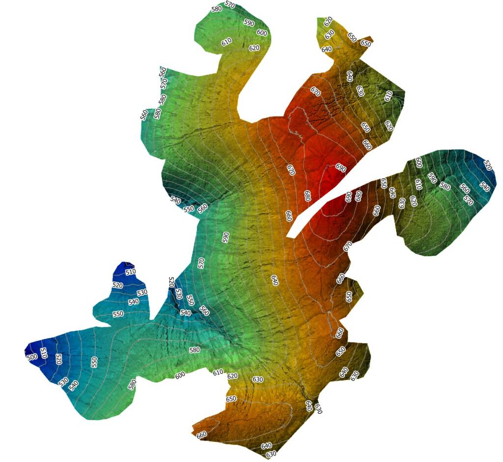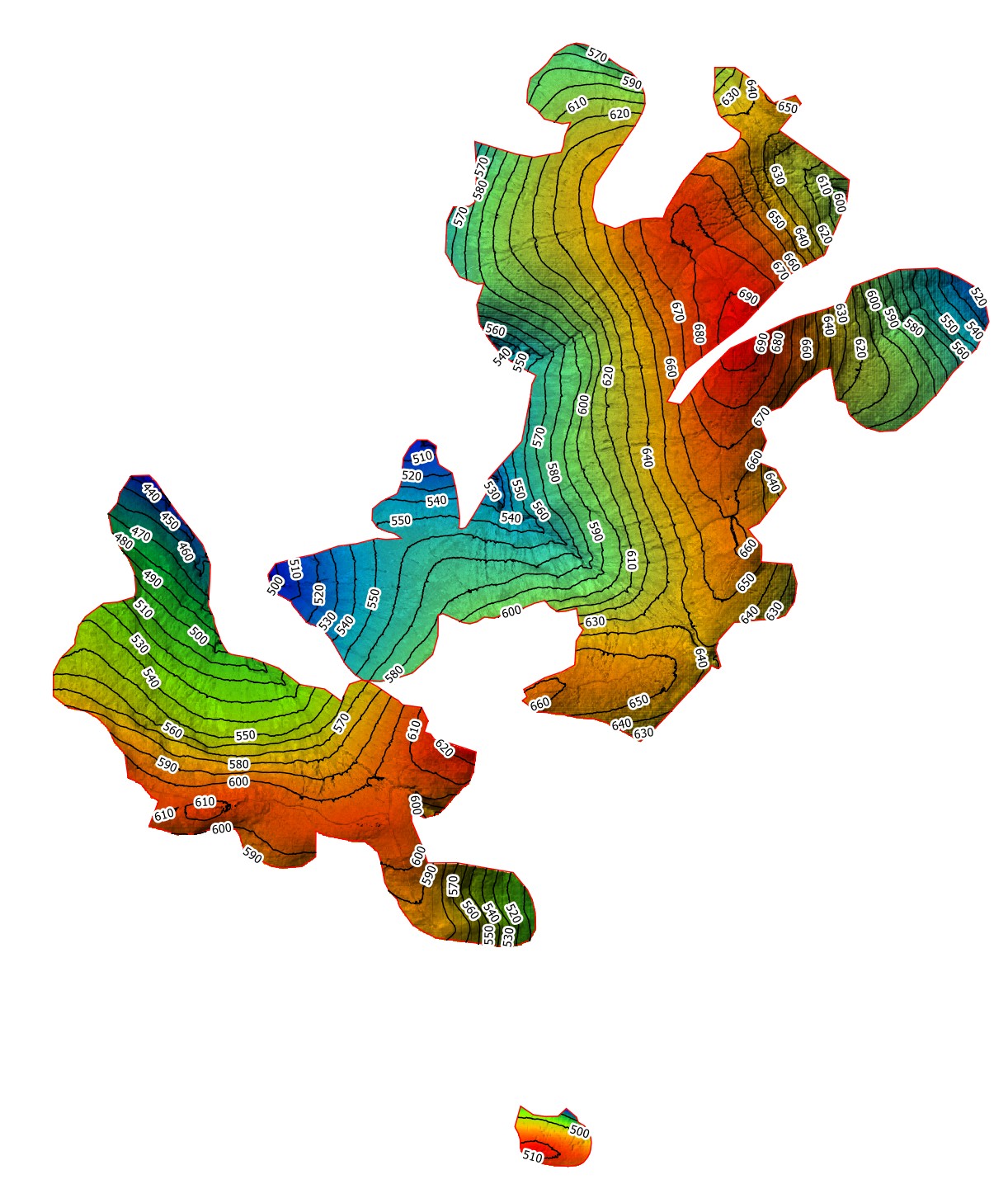
Last week of August saw us complete a 600ha aerial mapping survey for Peatland Restoration planning. With a stable weather window we teamed up with Boddy Environmental and deployed high on the Hills of Cromdale inside the Cairngorms National Park.
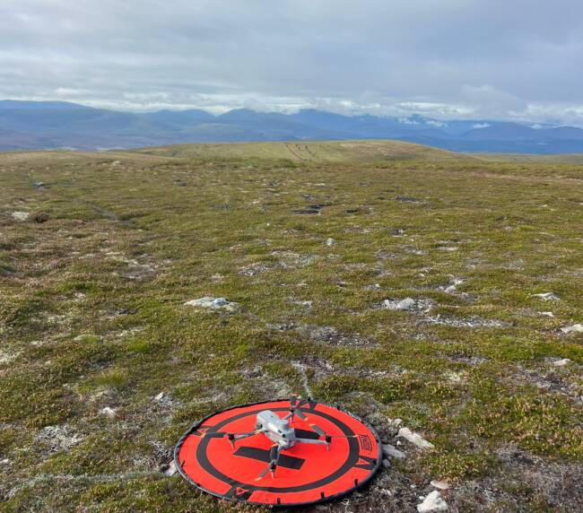
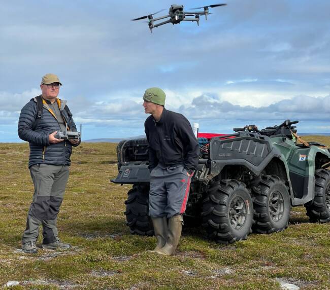
Having arrived onsite at 08:00 it took a further 2 hours to start flying as access was tricky so we used a combination of 4x4s to get as far as we could before travelling further on 4×4 and 6×6 ATVs.
Conditions where ideal on the hillside, light winds and light overcast skies. The Survey area was split into 3 distinct sub areas 2kms apart and we had 7 different take off and landing points throughout the day.
The Equipment:
DJI Matrice 4 Enterprise with Ntrip RTK corrections acquired by the use of a Starlink mini for uninterrupted Wi-Fi signal
Emlid reach RS3’s for installation of temporary ground control points.
All data was processed through Agisoft, Qgis and Virtual Surveyor producing highly accurate Orthomosaics, DSMs along with 1m Contours and Tin Surfaces.