
Aerial Mapping & Drone Surveys
Accurate. Efficient. Environmentally Focused.
Aerial Mapping & Corridor Route Surveys for Construction, Roads & Utilities
Precision drone data that keeps your project on-schedule and on-budget — from site topography to cable routes and road alignments.
At PB Aerial Imaging, we specialise in high‑resolution aerial mapping, drone surveys and topographic modelling—serving clients across the UK, particularly in Aerial Mapping & Corridor Route Surveys for Construction, Roads & Utilities, peatland restoration and construction site planning (pre‑ and post‑application). Harnessing cutting‑edge UAV platforms and sensors, we deliver detailed 2D and 3D maps with precision and speed.
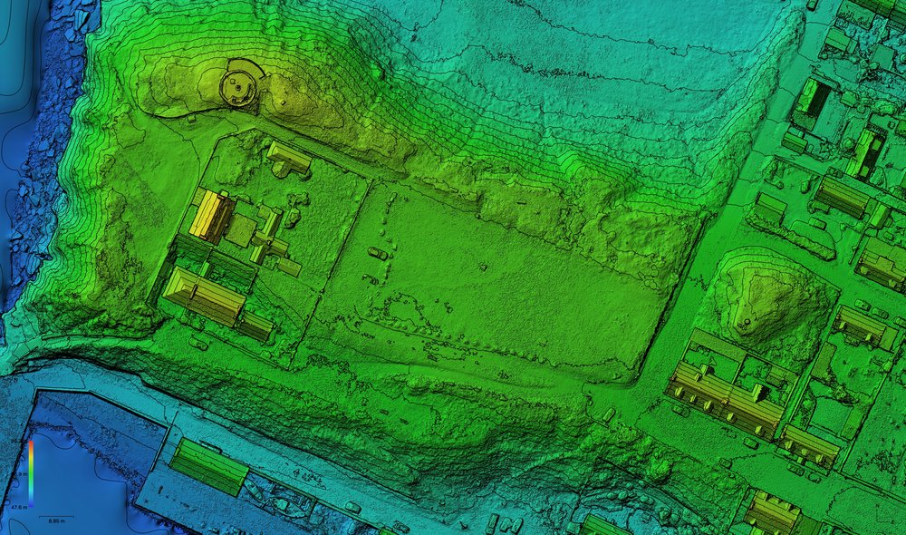
Construction Site Mapping & Corridor Mapping (Roads, Cables, Utilities
From groundwork to greenery, our drone surveys support every stage of construction site mapping:
Reduce Ground Survey Costs: Faster than traditional boots-on-the-ground methods, with high-accuracy georeferenced data. AeroViews
Better Stakeholder Communication: Clear orthomosaics and 3D models that integrate directly with design and planning teams. Aerolytics
Progress Tracking & Reporting: Regular aerial captures help show milestones and detect deviations early. Sky Revolutions
Our surveys reduce costs, increase speed, and enhance accuracy across the construction lifecycle.
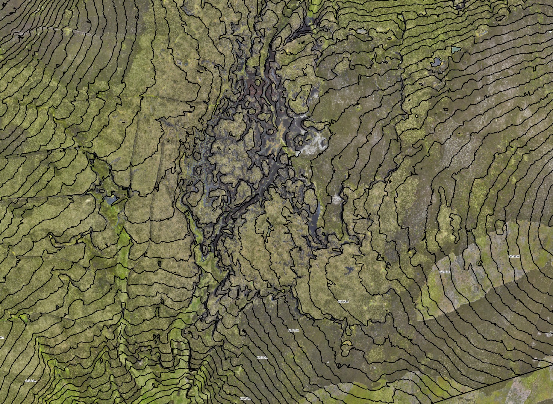
Drone Mapping for Peatland Restoration
Drone mapping isn’t just efficient—it’s essential. Our UAV mapping services support peatland restoration projects by providing ultra‑high‑resolution orthomosaic maps, digital surface models (DSM/DTM), and volumetric analysis. This enables:
- Assessment of peatland condition, including drainage channels (grips and gullies), haggs and erosion features
- Monitoring before and after restoration works—quantifying change, tracking rewetting and habitat recovery using LiDAR, RGB, multispectral, and thermal sensors NatureScot
- Deliverables compatible with GIS platforms (ArcGIS/QGIS) for ecological consultants, land managers, and planners
Whether you’re working on upland reservoirs, bog rehabilitation or grant-supported carbon offset projects, our peatland mapping gives the data you need.
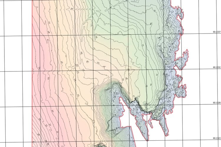
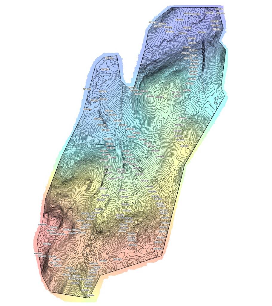
Our Mapping Services & Outputs
📌 We deploy RTK‑GPS drones with multispectral, thermal and RGB sensors to capture precise data. Your deliverables include:
- GeoTIFF orthomosaics
- Point clouds (LAS/LAZ)
- Contour and cross-section data
- DTMs/DSMs for linear routes
- CAD ready DXF/DWG files
- BIM/GIS compatible datasets
All aerial mapping projects align with industry standards for metadata and accuracy—ideal for planners, ecologists and reporting professionals.
Why Choose Us?
✅ Specialist in Peatland Restoration & Construction Mapping
We’ve worked closely with clients managing peatland habitats and planning sites—from remote uplands to busy development zones.
✅ High-Level Accuracy & Compliance
Our surveys follow NatureScot and Peatland ACTION UAV guidance, with full metadata and sensor calibration
✅ Rapid, Cost-Effective Delivery
Drone-based mapping slashes the time and expense compared to traditional ground surveyors, with minimal environmental disruption.
✅ Insightful Reporting & Analysis
Receive actionable outputs—volumetrics, habitat features, vegetation health maps and erosion tracking—supporting defensible restoration and planning decisions.
Sample Use Cases: What We Map
- Pre‑planning site models for new construction or restoration zones
- Pre‑ and post‑peatland restoration surveys showing blocked drains, reprofiled slopes and habitat changes
- Ecological habitat mapping for carbon accounting, biodiversity surveys and rewetting evaluation
- Construction site monitoring, contour tracking and volumetric analysis
- Landscape-scale environmental mapping, oversite for wetland creation, forestry, or water management schemes
Enhance Your Project with Drone Mapping
Invest in professional aerial mapping and drone surveys that deliver clarity, compliance, and confidence—whether you’re restoring peatlands or submitting a planning application.
👉 Contact PB Aerial Imaging today to discuss your project.
🥇 Get a free consultation & bespoke quote for aerial surveys focused on peatland restoration or construction mapping.
