
The Future of Drone Technology in Asset Inspections: Autonomy, AI, and Actionable Data
Forget everything you know about drone asset inspections. Traditional methods slow you down and expose teams to unnecessary risks. PB Aerial Imaging’s next-generation drones deliver safer, faster, and more accurate results—capturing detailed data that drives confident decisions. Read on to see how autonomy, AI, and actionable insights are reshaping inspection workflows across renewables, oil and gas, and infrastructure. For further insight, visit this link.
The Rise of Autonomous Drones

Imagine drones that fly themselves, collecting data with precision. This is not just a vision; it’s happening now. Autonomous drones are changing the game by providing unparalleled safety and speed.
Enhancing Safety and Efficiency
Picture a world where your team no longer faces the dangers of traditional inspections. Autonomous drones take over risky tasks, keeping your crew safe. They inspect tough spots while you stay grounded. These drones reduce inspection time by a remarkable 60%, allowing your team to focus on analysis rather than execution. Plus, they operate at any time, ensuring maximum uptime. Discover more about this shift in efficiency and safety here.
The Role of Artificial Intelligence
Artificial Intelligence (AI) is the brain behind smart drones. It analyses data in real-time, spotting issues that might go unnoticed. With AI, drones learn from each flight, improving their performance. This technology enables precise inspections, helping you catch problems early. Imagine having a tool that predicts asset failures before they occur, saving you time and money. Most people think AI is complex, but it’s making inspections simpler and more reliable.
Real-time Data and Decision Making
Real-time data is a game-changer. Autonomous drones provide immediate insights, allowing you to make fast, informed decisions. You no longer wait for reports—your data is live. This speed transforms your workflow and boosts your response time to potential issues. The longer you wait, the more you risk costly downtime. Embrace the power of instant data to stay ahead.
Advanced Imaging Techniques
The magic lies in how data is captured. Advanced imaging techniques are vital for delivering detailed, actionable insights.
Precision RTK Drone Photogrammetry
RTK (Real-Time Kinematic) technology increases accuracy to the centimetre level. This precision is critical for detailed mapping and inspection, making it indispensable for projects needing high accuracy. Whether for construction or terrain assessment, RTK drones provide the data you need to make exact plans. The result? Superior project outcomes and reduced risk of costly errors. Learn how RTK technology is transforming industries.
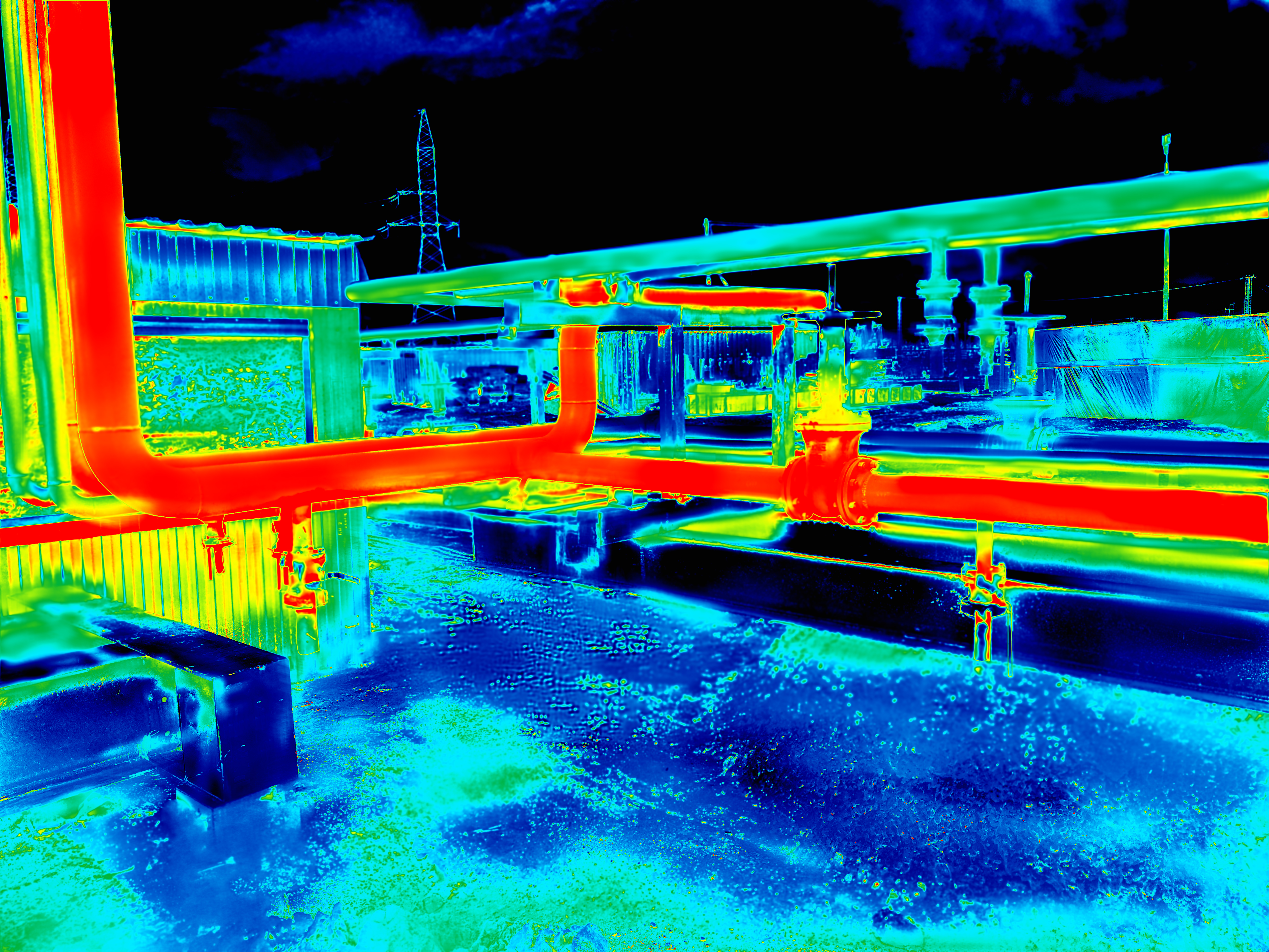
Thermal Imaging and LiDAR Mapping
Thermal imaging reveals hidden problems like heat loss or electrical issues. These insights lead to better maintenance decisions. Meanwhile, LiDAR mapping offers detailed topographical data. It penetrates surfaces, providing critical information about structural integrity. Combined, these tools empower you to maintain assets efficiently and safely. In the UK, LiDAR mapping is proving to be a key player in infrastructure projects.
Digital Twin and Predictive Maintenance
Digital twins are virtual models of your assets, updated in real-time. This technology allows for predictive maintenance, identifying potential issues before they occur. By simulating scenarios, you can plan interventions without disrupting operations. This proactive approach reduces downtime and extends asset life. Your team can now act before a problem arises, ensuring continuous operation and reduced repair costs.
Industry-Specific Applications
Drones aren’t just versatile; they excel in specific industries, transforming how inspections are conducted.
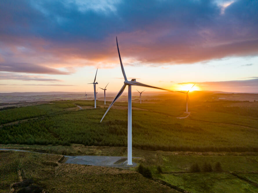
Offshore Wind Turbine Inspections
Offshore environments are challenging. Drones handle these conditions better than manual inspections. They deliver high-resolution data swiftly, reducing risks and costs. With drones, inspecting turbines becomes efficient and safe, ensuring your operations remain smooth. In the UK, these methods cut inspection times by 50%.
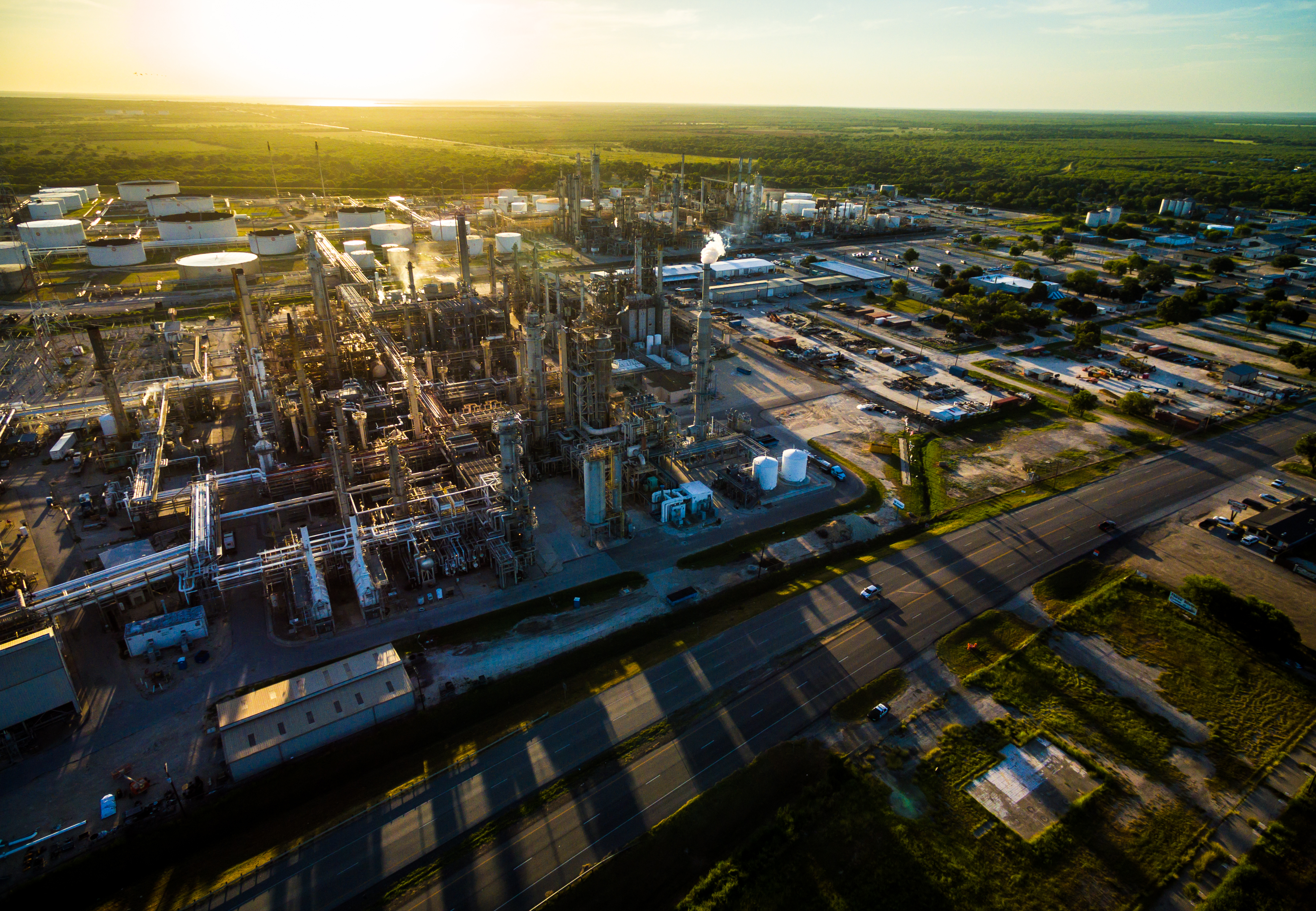
Oil and Gas Drone Surveys
The oil and gas industry demands rigorous safety and precision. Drones provide detailed surveys without exposing workers to hazardous conditions. They inspect pipelines and platforms, ensuring compliance and safety. This technology reduces downtime and enhances safety protocols, proving invaluable in complex environments. For more information on drone applications in oil and gas, check out this resource.
Confined Space and Infrastructure Inspections
Drones excel where humans struggle. In confined spaces, they navigate easily, capturing data without risk. They inspect infrastructure with precision, providing insights that drive maintenance strategies. This capability is crucial for industries such as construction and utilities, where access is often restricted. With drones, your inspections are thorough and safe, ensuring asset integrity.
In the evolving landscape of drone technology, PB Aerial Imaging stands at the forefront. Our expertise in autonomous drones and advanced imaging techniques empowers industries across the UK and EU. From offshore wind turbines to oil and gas surveys, our solutions deliver precision, safety, and efficiency. Trust in our innovation for your inspection needs, and unlock the future of asset management.
