

Revolutionising Construction: The Power of Innovative Drone Survey Techniques
Forget what you think you know about drone survey in construction projects. Traditional methods often miss critical details, leading to costly delays and rework. PB Aerial Imaging’s advanced aerial mapping and 3D modelling deliver precision surveying that sharpens your infrastructure mapping, saving time and improving accuracy from start to finish. Here’s how your projects can benefit from technology designed for results. For more insights, visit this article.
Cutting-edge Drone Survey Techniques

In the realm of construction, precision is the name of the game. Enter cutting-edge drone survey techniques, which are shifting the landscape of infrastructure projects.
Enhancing Precision and Accuracy
The key to successful construction projects lies in precise data collection. Drones offer unparalleled accuracy, capturing data with centimetre-level precision. This ensures that every detail is accounted for from the get-go. With drones, you can conduct surveys that traditional methods can only dream of achieving. The real-time data collected helps in making informed decisions, reducing the margin for error significantly. This means fewer surprises and more predictable project timelines.
Advanced Aerial Mapping Methods
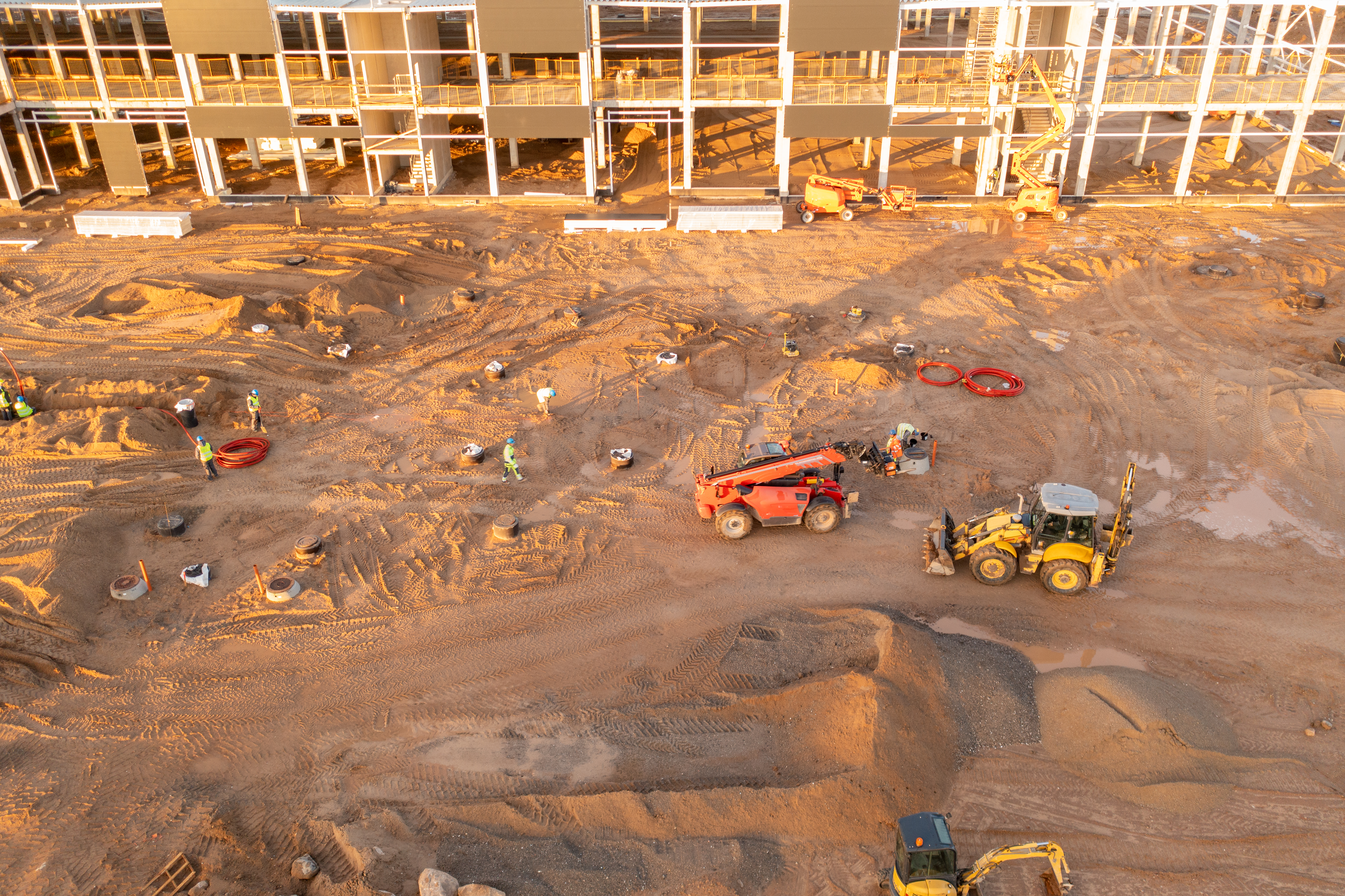
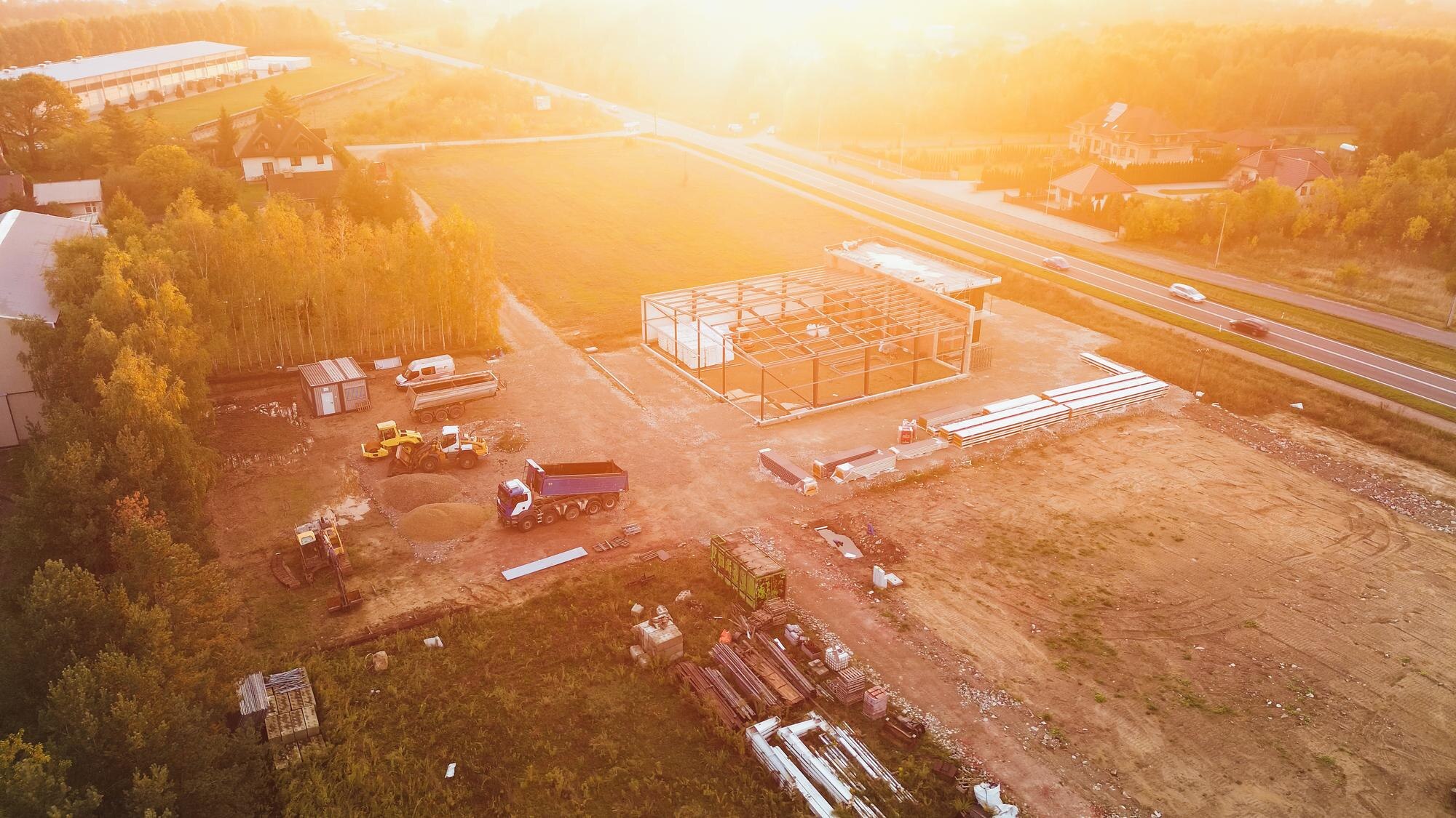
When it comes to aerial mapping, drones are at the forefront, offering a bird’s-eye view that is both comprehensive and detailed. This method allows project managers to identify potential issues early, thus saving valuable time and resources. With drones, mapping large areas becomes a breeze, providing high-resolution images that ensure no detail is overlooked. This leads to more efficient planning and execution, paving the way for smoother operations on the ground.
Benefits of 3D Modelling in Construction
3D modelling is a game-changer, offering a visual representation of construction sites that is both detailed and dynamic. It allows you to visualise the project from start to finish, offering insights that are crucial for effective planning. This technology aids in identifying potential design issues before they become costly problems. By using 3D models, teams can brainstorm solutions in a virtual environment, leading to better outcomes and enhanced innovation.
Advantages for Construction Projects
The advantages of integrating drone technology into construction projects are manifold. From efficient site analysis to improved project planning, the benefits are clear.
Efficient Site Analysis
Drones provide a quick and efficient way to analyse construction sites, cutting down the time required for traditional methods. This technology allows for quick assessment, providing comprehensive data that helps in making informed decisions. By using drones, you can gather information swiftly, ensuring that your project stays on track and within budget.
Comprehensive Infrastructure Mapping
Infrastructure mapping is crucial for successful project execution. Drones offer a level of detail that is unmatched, ensuring that every aspect of the construction site is covered. This comprehensive mapping helps in identifying potential issues early, allowing for proactive solutions. By leveraging drone technology, you can ensure that your projects are planned and executed with precision.
Improved Project Planning and Outcomes
Drones play a pivotal role in improving project planning and outcomes. They provide the data needed to make informed decisions, leading to more successful project execution. With drones, you can ensure that your projects are completed on time and within budget, resulting in higher levels of satisfaction and success. For more on the benefits of drones in construction, check out this article.
PB Aerial Imaging’s Expertise
PB Aerial Imaging is at the forefront of drone technology, offering unparalleled expertise and state-of-the-art solutions.
State-of-the-Art Drone Technology
Our company prides itself on using the latest drone technology to deliver high-quality results. Our drones are equipped with advanced features, ensuring that your projects benefit from the best that technology has to offer. This cutting-edge technology allows us to capture data with unprecedented accuracy, providing you with the insights you need to succeed.
Expertise in Precision Surveying
With years of experience in precision surveying, PB Aerial Imaging is your go-to partner for reliable and accurate data. Our team of experts is dedicated to providing you with the best service possible, ensuring that your projects are executed flawlessly. We understand the unique challenges of construction projects and are committed to helping you overcome them.
Case Studies of Successful Implementations
Our track record speaks for itself. We have successfully implemented drone technology in numerous construction projects, delivering exceptional results time and again. These case studies showcase our expertise and commitment to excellence, demonstrating our ability to deliver on our promises. For more examples of how drones are revolutionising site surveys, visit this link.
By choosing PB Aerial Imaging, you’re partnering with a leader in drone technology, ensuring that your construction projects are executed with precision and efficiency. The longer you wait, the more you risk falling behind. Embrace the future of construction today and experience the benefits of drone technology first hand.
