
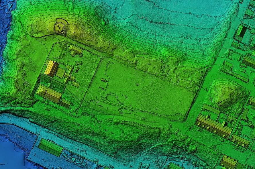
Survey-grade aerial mapping often feels like choosing between precision and access—until now. When your site is tough to reach but demands centimetre-level accuracy, settling for less isn’t an option. PB Aerial Imaging combines RTK/PPK photogrammetry and LiDAR to deliver pinpoint survey data, even in the most challenging commercial locations. Read on to see how this approach streamlines your project with reliable, CAD-ready outputs tailored for your workflows. For more insights on aerial mapping, check this link.
Precision in Aerial Mapping
Accurate aerial mapping is crucial for informed decision-making in various industries. Precision ensures the reliability of data used for planning and development.
Importance of Survey-Grade Accuracy
Survey-grade accuracy is vital for delivering reliable data. When mapping with drones, it means you can trust every measurement. This level of precision supports critical operations in construction, renewable energy, and more. High accuracy reduces the risk of costly mistakes. It ensures that every detail is correct, making your projects smoother and more efficient. The longer you wait to integrate such precision, the more you risk errors that can set back timelines and budgets.
Leveraging RTK and PPK Photogrammetry
RTK and PPK photogrammetry are game-changers in drone mapping. These technologies enhance positioning to centimetre-level accuracy. With RTK, real-time corrections are applied during the flight, while PPK processes data post-flight. This dual approach ensures high-precision results, reducing dependency on ground control points. By using these methods, you gain a solid foundation for boundary work and change detection. For a deeper dive into drone mapping, explore this resource.
Ground Control Points and Accuracy
Ground Control Points (GCPs) are markers on the ground that drone maps reference. They are crucial for ensuring accuracy in aerial surveys. With fewer GCPs needed, thanks to RTK and PPK technologies, you save time and resources. This method allows for quick setup and execution without compromising on precision. The result is data you can trust, ready for integration into systems like AutoCAD Civil 3D and GIS applications.
Overcoming Access Challenges
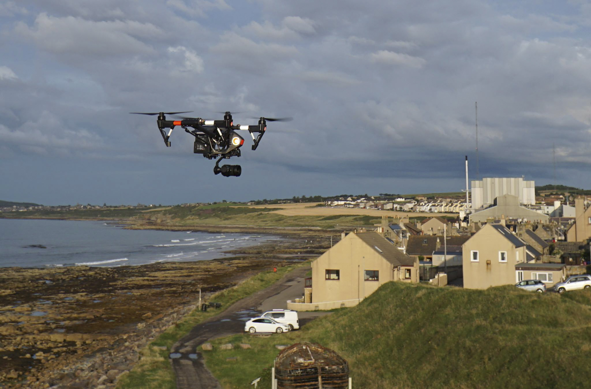
Reaching hard-to-access sites doesn’t mean sacrificing accuracy. With the right technology, you can achieve both.
Navigating Hard-to-Access Sites
Drones excel in accessing challenging locations. Whether it’s a remote wind farm or a dense urban construction site, drones provide a solution. They can quickly map areas that are difficult or dangerous to reach on foot. This capability not only saves time but also enhances safety. You avoid the risks associated with traditional surveying methods, while still obtaining detailed, reliable data.
LiDAR and Photogrammetry Solutions
LiDAR combined with photogrammetry offers comprehensive mapping solutions. LiDAR penetrates through vegetation, providing accurate elevation data. When paired with high-resolution photogrammetry, you get a complete picture of the terrain. This combination is perfect for projects like peatland restoration or infrastructure planning. Your data becomes a powerful tool for making informed decisions. To understand the impact of high-resolution surveying, check out this blog.
Safety and Compliance in Drone Operations
Safety and compliance are non-negotiable in drone operations. With GWO-certified pilots, PB Aerial Imaging ensures adherence to the highest safety standards. This qualification is crucial for operations in sensitive or regulated areas. You can be confident that your project is in capable hands, prioritising both safety and regulatory compliance. Operating safely means fewer disruptions and a smoother path to project completion.
Delivering Actionable Insights
The data gathered isn’t just numbers; it’s actionable intelligence that drives your projects forward.
Tailored Outputs for Commercial Applications
Every project is unique, requiring tailored outputs. Whether you need orthomosaics, DSMs, or volumetric analyses, PB Aerial Imaging delivers. These outputs are designed to fit seamlessly into your existing workflows, supporting everything from initial planning to ongoing monitoring. The insights gained are not only accurate but also directly applicable to your specific commercial needs.
BIM and GIS Workflow Integration
Integration into BIM and GIS workflows transforms raw data into valuable insights. With survey-grade mapping, your data is ready for advanced applications. You can easily incorporate it into GIS platforms or use it in AutoCAD Civil 3D. This integration streamlines processes, enhancing project efficiency and decision-making. The seamless flow of information from drone to desktop ensures your team stays informed and agile.
Mobilisation and Reporting Across the UK and EU
PB Aerial Imaging offers comprehensive coverage across the UK and EU. No matter where your project is located, mobilisation is efficient and timely. Detailed reporting provides clear insights, ensuring you have the information needed for strategic decisions. This coverage means you can rely on consistent quality and expertise throughout the region. To see the potential of aerial mapping in action, watch this demonstration.
Frequently Asked Questions
What are the benefits of using drones for survey-grade mapping?
Drones provide high accuracy, reach hard-to-access areas, and reduce the need for ground control points, saving time and resources.
How do RTK and PPK enhance drone mapping accuracy?
These technologies offer real-time or post-flight corrections, ensuring centimetre-level precision, critical for reliable data outputs.
Is PB Aerial Imaging capable of operating throughout the UK and EU?
Yes, PB Aerial Imaging provides comprehensive coverage across the UK and EU, ensuring consistent, high-quality service for all projects.
