
Drone inspections UK have reshaped how you manage risk and compliance in energy, construction and media projects. Relying on outdated methods puts safety and timelines under pressure. PB Aerial Imaging’s offshore drone inspection and aerial imaging deliver precise data and high-resolution photography that keep your operations ahead of challenges. Here’s how safer decisions come from above, cutting delays and boosting confidence in every sector you operate. Learn more about the rise of drone mapping in construction.
Drone Inspections: Safety and Precision
Embrace a new standard of safety and precision in your operations. Drone inspections offer a modern way to keep projects on track and ensure compliance.
Offshore Drone Inspection Standards
Navigating offshore environments is challenging, but drone inspections rise to the occasion. Equipped with high-resolution cameras and sensors, these drones capture critical data without risking human safety. This means you get accurate insights while keeping your team safe.
Imagine inspecting a rig in rough seas. A drone can fly close to the structure, capturing images that reveal potential issues without the need for scaffolding or boats. This approach saves time, reduces costs, and minimises risk. It’s no wonder that many companies are turning to drones to safeguard their offshore operations. For more on this, read about drone inspections.
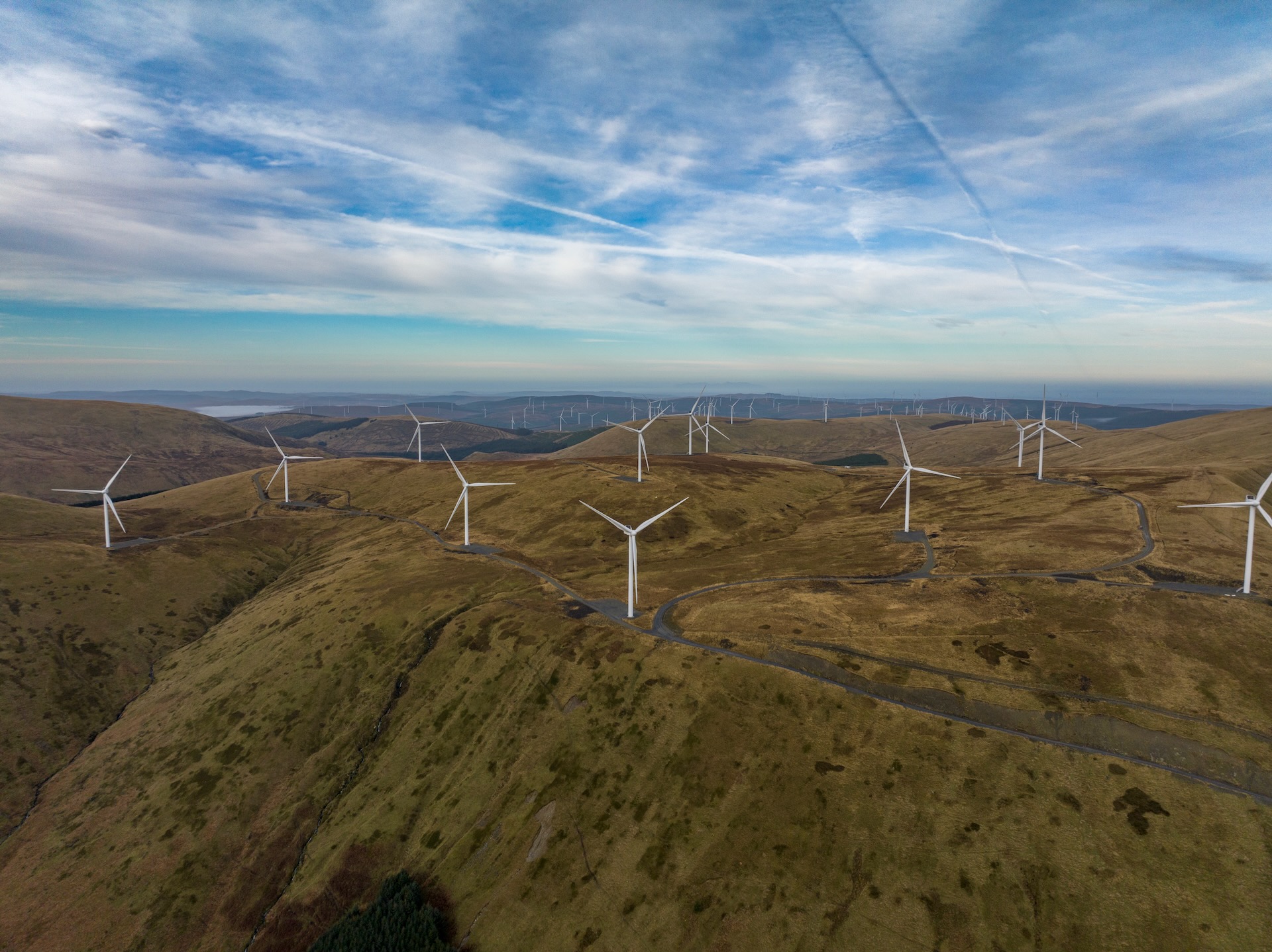
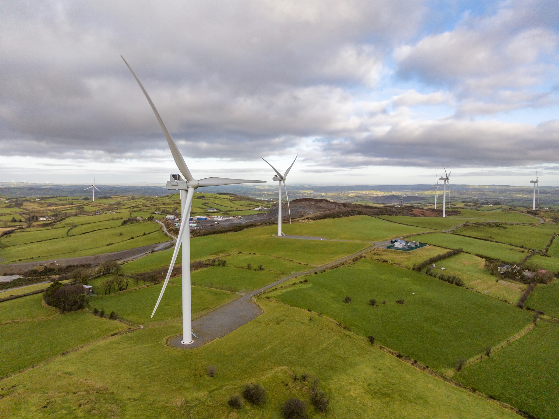
Wind Turbine Inspection Drones
Wind turbines need regular inspections to maintain performance. Drones make this task easier and safer by eliminating the need for workers to climb towers.
A drone can capture detailed images of turbine blades, hubs, and towers in minutes. This data helps identify issues like wear and tear or structural damage. With quick access to this information, you can schedule maintenance before problems escalate, ensuring turbines continue to generate power efficiently.
By choosing drone inspections, you’re not just keeping turbines running. You’re also prioritising safety and efficiency. Find out how drones benefit wind turbine inspections.
Oil and Gas Asset Inspection
In the oil and gas sector, asset inspection is crucial for safety and compliance. Drones revolutionise this process by providing rapid, detailed assessments.
Consider a pipeline that spans miles. Sending a drone to survey the line quickly identifies leaks or corrosion, helping prevent costly and hazardous incidents. This proactive approach keeps operations smooth and reduces downtime.
Drones also inspect tanks, rigs, and other assets without interrupting operations. This ensures continuous monitoring and quick response to potential threats. Learn more about drone inspections in the oil and gas industry.
Advanced Mapping and Surveying
Shift your perspective with advanced mapping and surveying. Drones capture precise data to guide informed decisions in construction and beyond.
Construction Drone Surveys
Drones are transforming construction sites with accurate surveys that enhance project planning.
Before breaking ground, a drone survey provides a comprehensive view of the land. This data is critical for identifying potential obstacles and planning resources effectively. By leveraging drones, you can avoid costly mistakes and accelerate project timelines.
During construction, drones continue to monitor progress, ensure compliance, and document changes. This constant oversight keeps your projects on track, and stakeholders informed. Discover the benefits of drones in construction.
Georeferenced Mapping Techniques
Precision is key in mapping, and drones deliver unparalleled accuracy. Georeferenced mapping techniques ensure every detail is captured.
Using advanced GPS technology, drones map large areas with centimetre-level precision. This is invaluable for tracking changes over time or planning new developments. The data collected is not just accurate; it’s actionable, allowing for informed decisions that drive project success.
Whether you’re monitoring a construction site or planning a new development, georeferenced mapping gives you the insight you need.
Orthomosaic Survey and 3D Modelling
Orthomosaic surveys and 3D modelling bring your projects to life with detailed visualisations.
Drones capture multiple images, stitched together to create an orthomosaic map—a single, high-resolution image of a site. This provides a clear view of terrain and structures, free from distortions.
3D models take it further, offering a realistic representation of the site. These tools are particularly useful for planning, analysis, and presentation. By visualising your project in 3D, you can spot potential issues and make data-driven decisions. More insights are available at CMIC Global.
Aerial Imaging in Media and Film

Elevate your production value with stunning aerial imagery. Drones offer new creative possibilities for media and film.
Cinematic Drone Filming Techniques
Capture breathtaking scenes with cinematic drone filming. These techniques add depth and perspective to your projects.
Imagine a sweeping aerial shot that sets the scene for your story. Drones provide this capability, capturing footage that traditional methods can’t match. With precise control and high-quality cameras, drones deliver smooth, dynamic shots that enhance any visual narrative.
By using drones, filmmakers can explore new angles and create visually stunning content that captivates audiences.
TV and Film Aerial Cinematography
Aerial cinematography turns ordinary scenes into extraordinary visuals. Drones provide the means to achieve these stunning results.
Whether shooting a high-action sequence or a serene landscape, drones offer the flexibility and range needed for creative shots. They can fly close to the action or soar high for panoramic views, adding a unique element to your production.
With drones, you can capture the impossible and produce content that stands out in a competitive media landscape.
High-Resolution Aerial Photography
High-resolution photography is essential for impactful visuals. Drones capture images that are clear, detailed, and vibrant.
From promotional materials to creative projects, high-resolution aerial photography sets a new standard. Drones can access angles and perspectives that are otherwise unattainable. This allows you to showcase your work in the best possible light.
Whether you’re capturing a cityscape or a remote location, drones provide the tools to create compelling imagery that resonates with viewers.
