
Forget old survey methods that slow your project down. Aerial mapping UK now delivers centimetre-level accuracy faster and safer than ever before. You’ll see how drone surveys Scotland and construction drone mapping provide detailed orthomosaic mapping, digital terrain models (DTM), and GIS-ready deliverables that keep restoration and infrastructure planning precise and on schedule.
Importance of Aerial Mapping in Construction

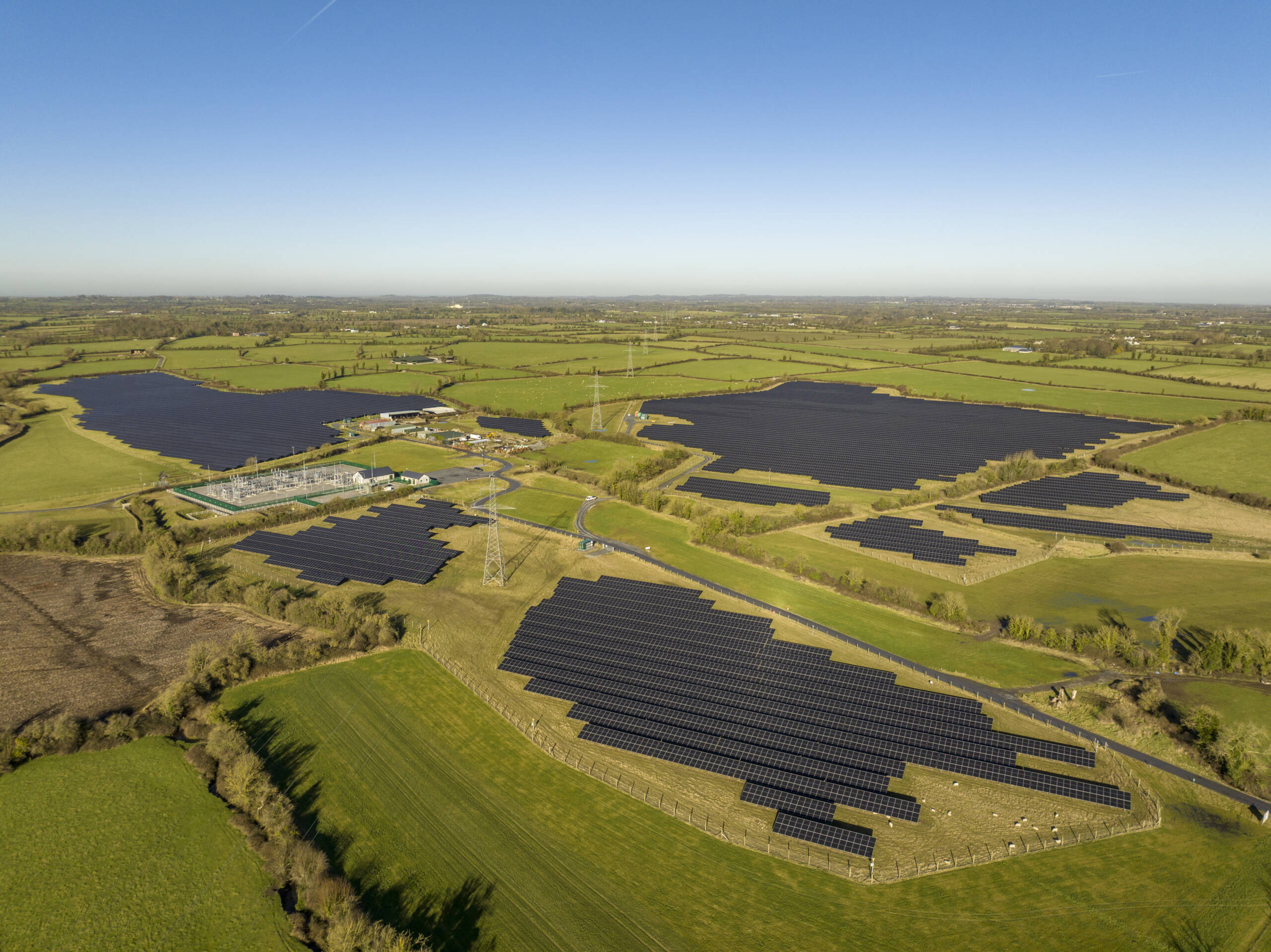
Aerial mapping is revolutionising how construction projects are managed. With precision data, projects are more accurate, safer, and completed faster. Let’s explore how drones bring these benefits to life.
Enhancing Accuracy and Safety
When it comes to construction, accuracy is everything. Drone-based mapping provides centimetre-level precision. This means you can be confident in your measurements, reducing errors and increasing safety on site. You no longer have to worry about miscalculations that could lead to costly mistakes. Instead, you gain peace of mind knowing your data is correct.
Safety is also improved. Traditional surveying can be risky, especially on rough terrain. Drones remove the need for workers to traverse dangerous sites. Instead, drones capture what you need from above. This not only saves time but also keeps your team safe. With the ability to gather high-resolution data, drones ensure that every corner of your site is covered without putting anyone in harm’s way.
Speeding Up Project Timelines
Time is money in construction, and delays can be costly. Aerial mapping is a game-changer here. Drones can survey large areas quickly, providing you with the data you need without delay. This means you can make faster decisions and keep your project on track.
Imagine cutting surveying time from weeks to mere days. That’s the power of drones. With quick data turnaround, you can start analysing and planning sooner. The rapid availability of data keeps your project moving forward, avoiding unnecessary downtime and accelerating your timeline.
Integration with BIM Systems
Building Information Modelling (BIM) is vital for modern construction. Integrating drone data with BIM systems enhances project planning. Drones capture detailed site information, which feeds directly into BIM software. This integration allows you to visualise projects in 3D, providing a comprehensive view of the site.
The real-time updates from drones mean your BIM models are always current. This ensures that project designs are based on the latest data. With accurate models, you can plan more effectively, reducing the risk of errors and rework. The seamless integration of drone data with BIM systems is transforming construction management, making it more efficient and precise.
Restoration and Environmental Applications
Beyond construction, aerial mapping serves vital roles in restoration and environmental monitoring. These applications bring new insights and capabilities to projects focused on sustainability and ecological health.
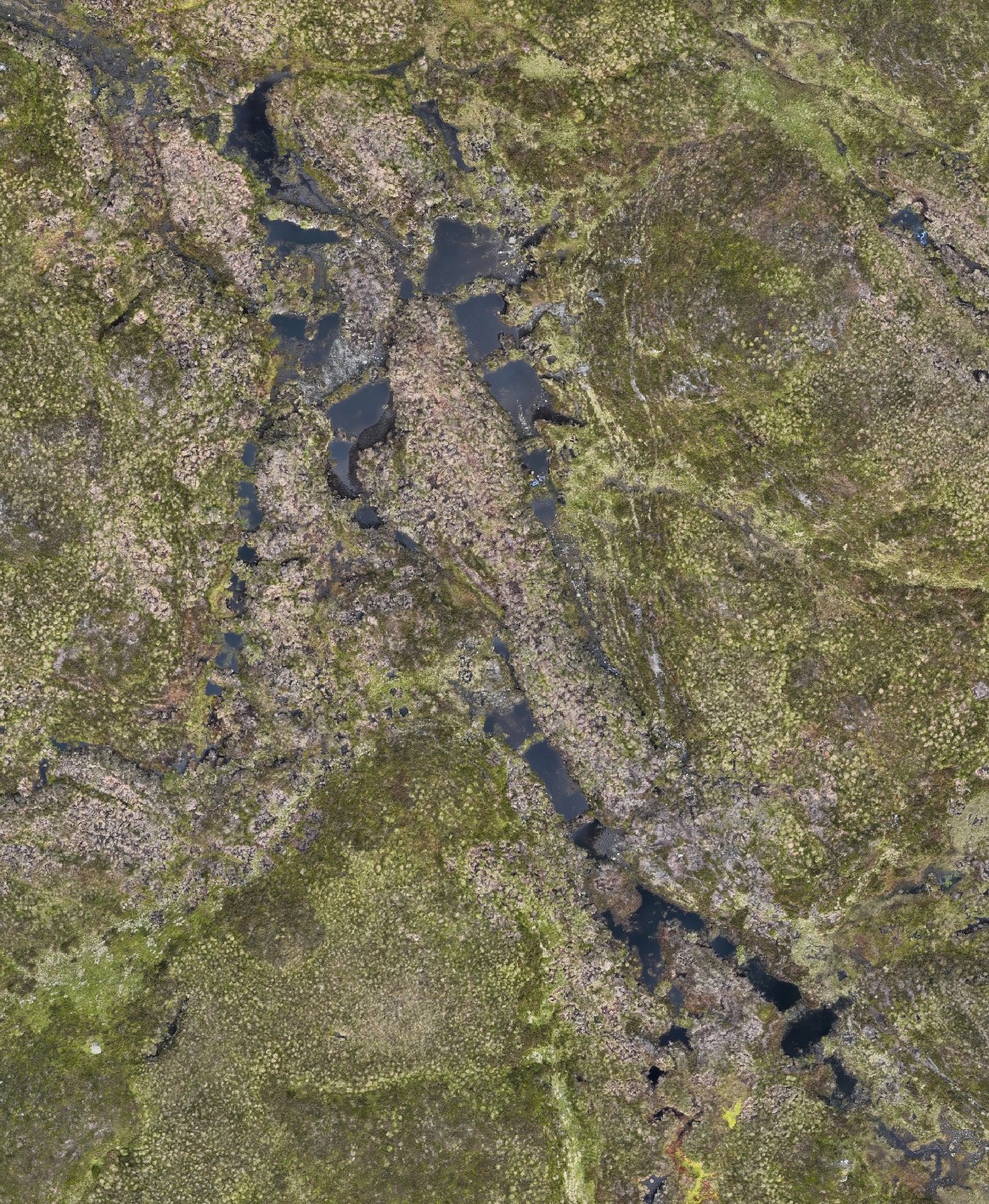
Peatland Restoration Mapping
Restoring peatlands is crucial for environmental health. Drones provide the perfect tool for mapping these sensitive areas. With high-resolution imagery, drones capture the intricate details of peatlands, aiding in restoration efforts. You can monitor changes over time, ensuring that restoration strategies are effective.
Drones help in identifying areas that require intervention, guiding restoration teams to focus their efforts where needed most. The data collected supports decision-making, helping you achieve your restoration goals efficiently.
Vegetation Health Monitoring
Understanding vegetation health is critical for many projects. Drones equipped with specialised sensors can assess plant health quickly and accurately. This technology enables you to monitor large areas in a fraction of the time it would take with traditional methods.
Regular monitoring helps in detecting issues early, allowing for timely interventions. Whether it’s agricultural lands or natural reserves, drones provide the insights needed to maintain healthy ecosystems. The ability to track changes in vegetation health supports sustainable management practices.
Multispectral Drone Surveys
Multispectral surveys offer detailed insights into environmental conditions. Drones equipped with multispectral sensors capture data across different wavelengths, revealing information not visible to the naked eye. This capability is invaluable for assessing soil conditions, water quality, and more.
With multispectral data, you can make informed decisions about land management and conservation. The detailed insights help in understanding complex ecological interactions, supporting efforts to protect and enhance natural environments.
Infrastructure Planning and Asset Management

Aerial mapping is indispensable in infrastructure planning and asset management. It provides the data needed to make informed decisions, ensuring projects are planned and executed with precision.
RTK and PPK Photogrammetry
RTK and PPK photogrammetry are essential for accurate mapping. These techniques use drones to capture precise geospatial data. With real-time kinematic (RTK) and post-processed kinematic (PPK) methods, you can achieve high accuracy in your surveys.
This level of precision is crucial for infrastructure projects. Whether you’re laying out roads, pipelines, or other structures, RTK and PPK ensure that your plans are based on accurate data. The result is more reliable project outcomes and reduced risk of costly mistakes.
Digital Terrain and Surface Models
Creating digital terrain and surface models is a breeze with drones. These models provide a detailed representation of the land, crucial for planning infrastructure projects. You gain insights into elevation changes, drainage patterns, and more.
With accurate models, you can plan projects with confidence. The data supports decision-making, helping you choose the best routes, avoid hazards, and optimise designs. Digital models provide the foundation for successful infrastructure development.
Asset Inspection and Progress Monitoring
Drones excel in asset inspection and progress monitoring. They provide a bird’s-eye view, capturing detailed images of your assets. This capability is invaluable for maintenance and monitoring progress over time.
Regular drone inspections keep you informed about the condition of your assets. This proactive approach helps in identifying issues early, preventing costly repairs down the line. For progress monitoring, drones track how projects are evolving, ensuring everything stays on schedule.
Aerial mapping’s role in construction, restoration, and infrastructure planning is undeniable. The precision and efficiency it offers are transforming how projects are executed, supporting more sustainable and successful outcomes.
